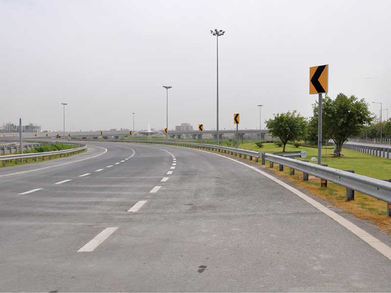
North East Link Comprising Victoria’s 17m-dia Road Tunnels

Circling its way around Melbourne, the city’s highway network had long struggled with one essential missing link – a connection from the M80 to the Eastern Freeway. The North East Link, comprising Victoria’s longest road tunnels, makes that connection, taking 15,000 trucks off congested streets, improving the environment, reducing noise and pollution, while shaving 35 minutes off travel times. It will be of enormous benefit to Melbourne residents.
This enormous project, required twin tunnels 6.5km long, three major underground road interchanges, and, some extensive and sophisticated 3D geological modelling. Costing $11 billion (AUD) and due for completion in 2028, the 17m-diameter road tunnels will be at the heart of Victoria’s largest infrastructure project.
Building the link presented two major challenges (among a host of others): How to fully understand the subsurface that the tunnels would be driven through and (just as importantly), how to share that information with the seven infrastructure design consultancies that would need to work together to deliver the additional elements of the far-reaching scheme.
The task was assigned to Spark, a global consortium of multiple constructors. They quickly realised the value of establishing a detailed 3D model to visualise the complex geological conditions and risks, and aid communication with the legion of stakeholders. Spark engaged engineering consultants WSP to provide ground engineering services in the design phase and carry out a range of geotechnical site investigations.
Building upwards from a Leapfrog Works model
It was an undertaking that would engage more than 300 people over nearly two and half years, delivering around $30m (AUD) of site investigations, with a similar figure going on detailed subsurface modelling and ground engineering design analysis.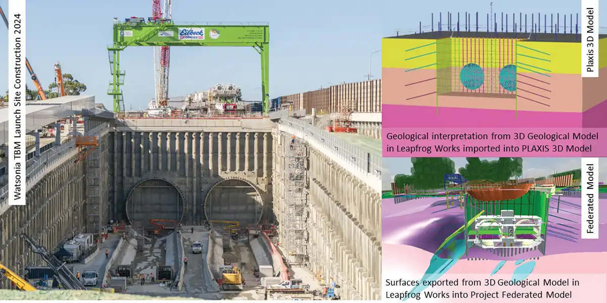
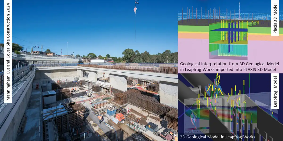

Starting with a baseline model of Melbourne’s regional geology in Leapfrog, they steadily incorporated the data of more than 1900 boreholes, and thousands of in-situ measurements and lab test results. A programme of targeted additional site investigations was developed to fill the gaps and refine geotechnical resolution in key areas.
More than 370 multidisciplinary design packages from native 3D digital design models were stored in the common data environment of Bentley’s ProjectWise platform. Each needed to be fully coordinated with the latest information, before being used as the basis for design drawings, schedules, and construction set-out information.
Spotting the risks to construction and budget
When key geotechnical and hydrogeological risks are not identified, they can delay projects and push up costs. By isolating geological features in the model, the teams were able to find savings and optimisations in the PLAXIS-led designs. These included:- Identifying the risk of a planar sliding rock mass during the design of the 35m deep piled retention system. Optimising the design saved around $2m (AUD).
- Identifying a paleochannel at the tunnel horizon. Visualising the tunnel’s intersection with it reduced the risks associated with such unstable ground.
- Spotting rapidly changing weak geological figures, such as dykes and faults. Using Leapfrog’s ability to combine multiple data types, the ground models could be refined, and the diaphragm wall embedment depth optimised, saving $10m (AUD).
- Digitisation of deep excavation plans led to the quantity of material designated as waste being halved. Using the Leapfrog geological model improved the accuracy of spoil classification. Over one million cubic metres of material could then be recycled for use in project construction rather than sent to landfill.
A digital environment for a better environment
The implementation of a digital strategy on the North East Link improved communication, enhanced the quality of design and construction and mitigated risks, particularly those associated with geotechnical conditions.Facing the sheer volume of site investigation data available for the North East Link Project, Spark together with WSP, leveraged the efficiencies provided by Leapfrog Works, PLAXIS and ProjectWise digital environments to rapidly deliver up-to-date subsurface ground modelling for use in design analyses and construction planning.
Implementing Leapfrog Works at the scale reflective of this mega project has supported remarkable sustainability outcomes, refined management of subsurface ground risks, and advanced Spark’s best practice digital engineering aspirations.
Spark and WSP were the Subsurface Modelling and Analysis winners in the Bentley 2024 Going Digital Awards in Infrastructure awards for their work on the North East Link. For the project summary, go here.
Published on:
12 June 2026
Published in: NBM&CW JUNE 2026
Share:
We Value Your Comment