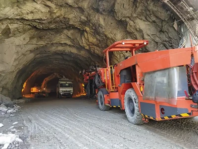
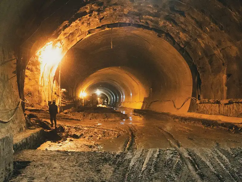
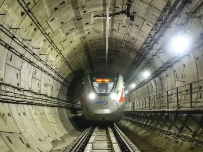
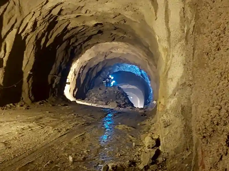
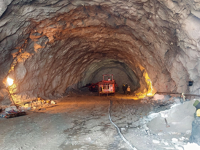
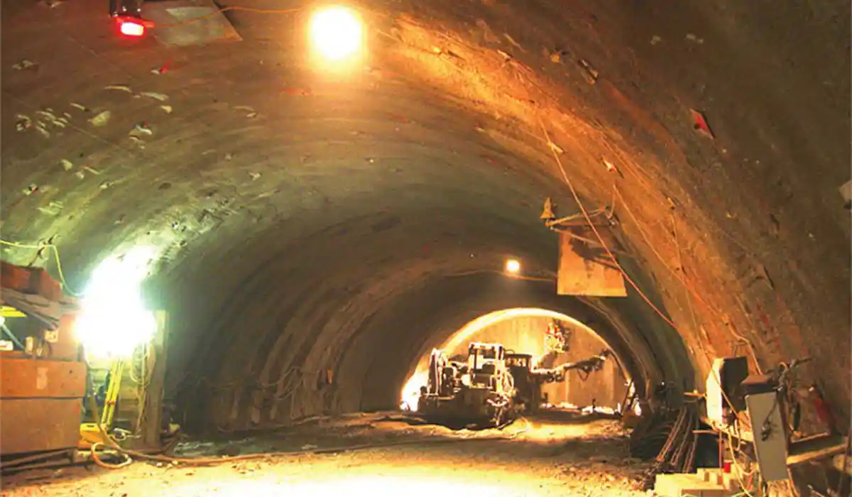

Orogenesis
Mountain belts which are created by continent-continent collision represent the most dominant and unique geologic features on the surface of the Earth. Some of the best examples of such continent-continent collision which lead to orogenesis are the Rockies and the Appalachian belt in North America, the Andes in the South America, the Ural Mountains in Central Eurasia, the Alps of Europe, and the Himalayas in Asia. The youngest and the most impressing of all such collisional belts is the Himalayan orogeny. The Himalayan mountain ranges are the product of collision between the India and Eurasian plate and a live example of collision mountain belt as the process of mountain building is still active, forming the highest range and plateau in the world.

The Himalayan mountain belt extends over 2500 km from northwest to northeast with a variable width of 230 to 330 km. The Himalayan terrain from South to North has been divided into sub-parallel tectonostratigraphic sub-divisions as under:
- Sub-Himalaya or Outer Himalaya
- Lower Himalaya or Lesser Himalaya
- Higher Himalaya or Greater Himalaya
- Trans Himalaya or Tibetan Himalaya
- Main Frontal thrust (MFT): Between Indo-Gangetic alluvial planes and Outer Himalayas.
- Main Boundary Thrust (MBT): Between Outer Himalayas and Lesser Himalayas.
- Main Central Thrust (MCT): Between Lesser Himalayas and Greater Himalayas.
- Southern Tibetan Detachment system (STD): Between Greater Himalayas and Trans Himalayas.
Tunnelling in Himalayas
The government plans to build massive hydroelectric projects in the mountainous ranges to tap the renewable energy from gushing rivers; build road tunnels to connect the remote locations so that all-weather connectivity can be provided to the locals and the Armed Forces; and rail tunnels to connect the remotest location with the rail lines so that transportation, which once was a daunting task, will become smoother. All these underground structures have been planned in the complex geology of the Himalayas in the extreme vicinity of the tectonostratigraphic divisions mentioned above.

Challenges encountered in various tunnelling projects
Tunnelling through the weak, fragile, and jointed rock masses of Himalayas is a challenging task. Tunnelling problems could be fault/thrust/shear zones, running ground conditions, heaving, squeezing and swelling, rock bursting, ground water inflow, hot temperature conditions and gases in rock, wedge/block failures, etc.
Due to an active tectonic zone, encountering fault/thrust/shear zones while tunnelling in the Himalayas is inevitable. A shear zone has sub-parallel walls in which deformations are localized as a result of folding, faulting, and thrusting. The shear zones, if combined with water ingress, (which occurs usually), hampers the progress of tunnelling considerably and, in some cases, there can be a complete break.
Dul-Hasti Hydroelectric project: The 390 MW Dul-Hasti hydropower project is a run-of-the-river scheme, constructed on river Chandra, a tributary of river Chenab that lies within the Lesser Himalayan Zone and is characterized by a unique plateau like feature with schists and gniesses on the western side and quartzites on the eastern side. The tunnel encountered a number of small and major faults and shear zones with crushed gouge material.
Figure 3 shows the muck flow when a shear zone was encountered during tunnelling. The incident happened after a shear zone was punctured, rendering the tunnelling extremely difficult. The shear zones were dipped steeply, striking oblique to the tunnel axis, and covering a length of 15 to 20 m along the tunnel alignment.

Mostly, shear zones are associated with confined aquifers with high aquifer head. The shear zones along tunnel axis are usually projected from the geological mapping. However, in metamorphic terrain, due to being severely folded and faulted by tectonic events, the geology may significantly differ from surface geological mapping and hence, in such a terrain, advance probe hole technique during tunnelling has proved to be effective to ascertain the nature of the geological condition.
At Dul-Hasti, advance probe holes of 45 m length were found to be very effective during tunnelling in a shear zone closely associated with confined aquifers.

Tapovan - Vishnugad Hydropower project: The 520 MW Tapovan-Vishnugad hydropower project is a run-of-the-river scheme. It lies within Dhauliganga and Alaknanda valleys in Uttrakhand with high-grade metamorphic rocks of Central Himalayan crystalline series. Since the tunnel site has the main central thrust (MCT) in the vicinity, a number of small and big shear zones and faults were encountered while tunnelling, which resulted in a delay of 17 months. The situation was tackled by the following measures:
- Advance cement grouting for face and crown stabilization.
- Umbrella pipe roofs of 114 mm diameter, 15 m long @ 0.3 m spacing from SPL to SPL to ensure crown stability.
- For seepage control, drainage pipes of 76 mm diameter were installed.
- Excavation was done by breaking using Multi Drift Method.
- Pull length restricted to 1 m.
- Steel ribs (ISMB 250) at 0.6 m spacing were provided.

The tunnelling work started in August 2010 and progressed well upto 1902 m, but in December 2011, the quality of rock encountered started deteriorating, resulting in long delays and slow advancements. Excessive deformation due to squeezing ground condition occurred subsequently. The project was delayed by approximately 5 years due to the geological surprise encountered in the form of the Seri Nallah fault zone (Figure 6).

The mitigating measures included:
- Excavation in segmental phases
- Installation of double rows of 89 mm diameter pipe roofing umbrella
- Probe hole drilling for assessment of advance geology
- Tunnel Seismic Prediction (TSP) tests conducted on the face to get a better understanding of muck flow condition and the rock strata.
- Plug
- Probe
- Pressure Relief
- Protection of roof
- Pre-Grout and Support

Squeezing, heaving, and swelling
At depth, the state of stress within the rock mass is disturbed due to tunnel excavation. The stresses are redistributed with time to achieve a new state of equilibrium - commonly known as the “natural healing process” of rock mass. When the stresses are low and less than in-situ rock strength, there are no tunnel stability problems, however, when the stresses exceed the in-situ strength, it initiates the process of progressive failure around the periphery of the tunnel opening. The failure of rock mass due to overstressing and movement of the failed rock mass into the tunnel opening is called squeezing.
Maneri Bhali project: The Maneri Bhali project experienced severe squeezing within a 40 m length of 6 m diameter tunnel. The highly crushed, pulverised and thick contact of metabasics and the qaurtzites were highly strained due to active tectonic folding. To overcome the problem, the horse-shoe section was changed to circular section and instruments installed to monitor the troubled zone.
Nathpa-Jhakri project: In the HRT of Nathpa-Jhakri, highly converging strata has been encountered due to high ground stresses where quartz mica schist striking sub-parallel to tunnel were encountered. They were reflected in the form of cracks in the shotcrete, bending and buckling of steel ribs and reduction of tunnel section. To mitigate the risky situation, the problem was tackled by over-excavation and supporting it with steel ribs.
To overcome the effect of excessive deformation and squeezing rock mass, the rate of deformation must first be analysed by continuous monitoring in the particular region. In addition to that, yielding supports and pressure relief holes (as shown in Figure 9) should be applied with remedial measures during excavation to control the deformation.

Rock bursting, spalling, and slabbing
Rock bursts or spalling are caused by overstressing of brittle, massive rocks often at a depth more than 1000 m below surface. At shallower depths, these failures can be induced where high horizontal stresses or strongly anisotropic stresses are acting.
Parbati Hydroelectric Stage II: This project lies in the Lesser Himalayan region. Being very close to the main central thrust (MCT), the rocks along HRT have undergone intense compression and are therefore folded, faulted, foliated and jointed - typical characteristics of Himalayan rocks. The excavation was done by open-face hard rock TBM of 6.8 m diameter for a particular section comprising of granites/gneissose granites followed by quartzites.
Due to the presence of four primary joint sets and random joints, a large block of 6 m * 2.5 m separated from the crown, forming a cavity. As the area was inaccessible, the rock bolter could not reach the height of cavity and pre-grouting was not possible because of tight joints. To tackle this, ring beams were installed, the rock was supported with channels and girders, and the cavity was backfilled with concrete. The whole process delayed the project by more than three weeks. With this experience, modifications were made in the TBM by mounting an extension drilling system. The next 250 m created similar problems of wedge/block failure resulting in overbreaks of more than 5m which were backfilled with concrete.

Conclusion
The case studies indicate that tunnelling in the tectonically active Himalayan terrain (which is characterized by widely varying geology with folds, faults, thrusts and shear zones along its entire belt), geological uncertainties cannot be ruled out. The problems occurring due to geological surprises can be minimised and mitigated by geological investigations and adopting advanced measures.
Before the tendering process of any tunnel project, a detailed project report (DPR) should be prepared by performing geotechnical investigations like bore logging along the alignment proposed to understand the in-situ stress conditions in the rockmass and pre-construction surveys like Airborne Electro-Magnetic survey (AEM), Seismic Refraction tests and Electrical Resistivity tests to understand the groundwater conditions and rock mass properties be carried out adhering to standard technical specifications. The report should comprise of detailed test results of all the investigation methods mentioned above. This will facilitate easier recognition of the ground conditions and prepare the stakeholders of any uncertainty that can be encountered during the execution of the project, which will help save resources.
References
- Carter, T. G. (n.d.). Himalayan Ground Conditions challenge innovation for successful TBM Tunnelling.
- Kumar Yadav, V., Kumar Angra, P., & Kumar, V. (n.d.). Indian Geotechnical Conference-2010.
- Rao, S. K. (2017). Necessity of NATM tunnel in Himalayas - A Case Study of Rohtang Tunnel. https://www.researchgate.net/publication/320729563
- Karki, S., Chhushyabaga, B., & Khadka, S. S. (2020). An Overview of Design and Construction practices of Himalayan Hydropower tunnels. Journal of Physics: Conference Series, 1608(1). https://doi.org/10.1088/1742-6596/1608/1/012008
- Tunnelling in the Himalayan Region: geological problems and solutions. (n.d.). https://www.researchgate.net/publication/269407897